Rozelle Interchange connects the M4 to the Anzac Bridge and the M8 to City West Link and Victoria Road. Delays are expected on approach to the Anzac Bridge citybound from 7am to 9am in the morning peak.
Travelling to the City
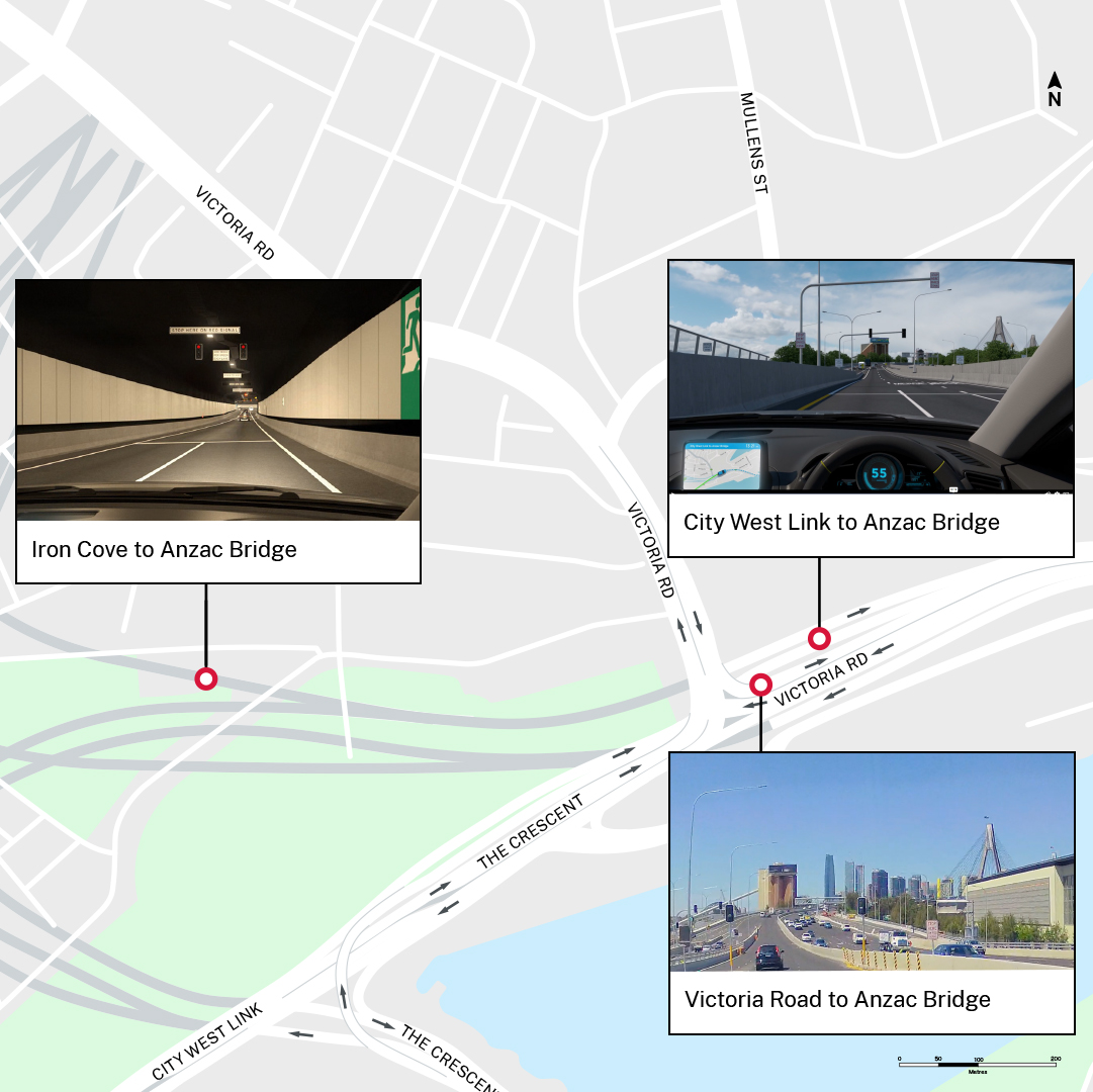
- From Victoria Road: Keep to the right on Iron Cove Bridge to access the toll-free tunnel. Once inside the tunnel, use the left two lanes to connect directly to Anzac Bridge. No tolls apply. Take a virtual drive.
- From M4 East: Continue past the Wattle Street exit and use the left two lanes to continue along the M4 tunnel and connect directly to Anzac Bridge. A maximum toll of $12.25 per journey applies for passenger vehicles. Take a virtual drive.
- From M8: Keep to the far left in the M8 tunnel and take the exit on the left to City West Link. When exiting the tunnel to City West Link, use the left two lanes for the City. A maximum toll of $12.25 per journey applies for passenger vehicles. Take a virtual drive.
Travelling from the City
- To Victoria Road: Keep to the far left on Anzac Bridge and take the first exit on the left to the toll-free tunnel connecting directly to Iron Cove Bridge and Victoria Road. Take a virtual drive.
- To M4 East: Keep to the left on Anzac Bridge to connect directly the M4 tunnel. A maximum toll of $12.25 per journey applies for passenger vehicles. Take a virtual drive.
- To M8: Use the right two lanes on Anzac Bridge to continue onto City West Link. Keep to the right after The Crescent for the M8 tunnel. A maximum toll of $12.25 per journey applies for passenger vehicles. Take a virtual drive.
View more virtual journeys using Rozelle Interchange here.
Tolls
Rozelle Interchange is part of WestConnex. All WestConnex tolls are calculated using a ‘flag fall’ of $1.73 at the point of entry and then $0.64 per kilometre. After 16.4 kilometres of continuous travel, a toll cap comes into effect. For passenger vehicles, tolls will be capped at a maximum amount of $12.25 per journey. For heavy vehicles, the maximum toll cap is $36.75 per journey. (Information as of 1 Jan 2025)
Watch this Rozelle Interchange flyover video below to learn more.
Ramp Signals
Ramp signals are operating at key locations on approach to Anzac Bridge;
- Victoria Road to Anzac Bridge
- City West Link to Anzac Bridge
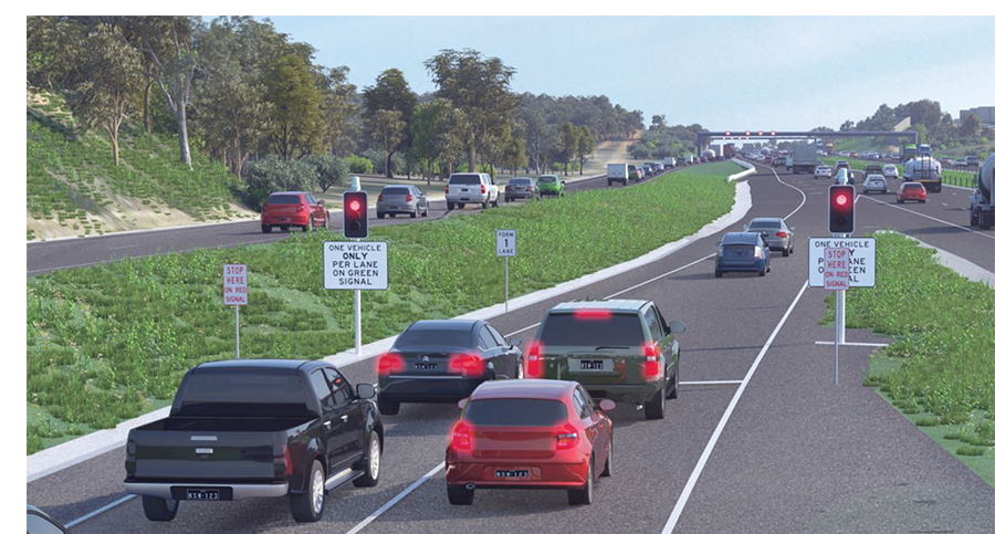
Ramp signals control the rate of vehicles exiting the Interchange on approach to Anzac Bridge. The signals can be set for different metering rates to improve traffic flow and minimise congestion. They make merging safer and easier and reduce the risk of drivers having to brake suddenly.
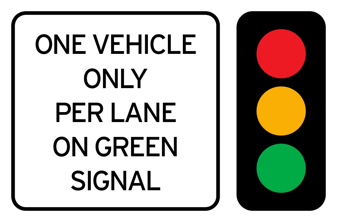
The signals allow one vehicle per lane to enter when a green light is displayed. The green signal allows the first vehicle in each lane to join the Anzac Bridge. When the signal is red, you must stop behind the ‘Stop’ line.
Ramp meters are activated during peak traffic periods or when there is heavy traffic congestion.
What are ramp meters and how do they work?
Ramp meters use traffic signals at motorway on-ramps to control the rate of vehicles entering the motorway. The signals can be set for different metering rates to improve freeway flow and minimise congestion. They make merging safer and easier and reduce the risk of drivers having to brake suddenly.
They control the flow of vehicles entering the motorway by allowing one vehicle per lane to enter when a green light is displayed. The green signal allows the first vehicle in each lane to join the motorway. When the signal is red, you must stop behind the ‘Stop’ line.
Ramp meters are activated during peak traffic periods or when the motorway experiences heavy congestion. They work by monitoring traffic conditions to ensure a steady and controlled flow of vehicles, reducing congestion and making it easier to merge onto the motorway.
For information about driving safely in tunnels, visit https://www.linkt.com.au/help/using-toll-roads/tips-for-driving-in-tunnels/sydney
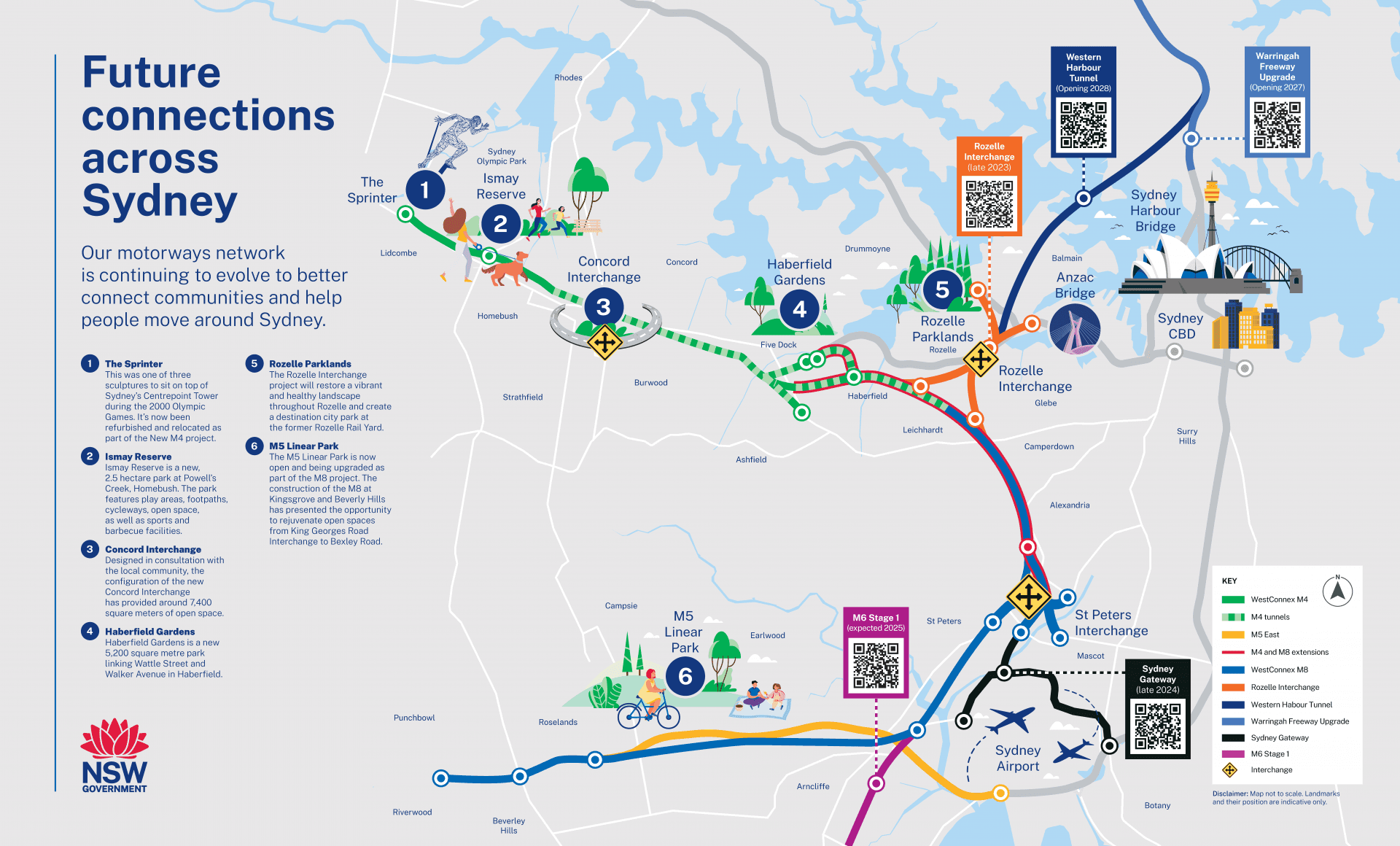
Future Connections
Our motorways network is continuing to evolve to better connect communities and help people move around Sydney.
Download our Future Connections Across Sydney map here.
The owner and operator of Rozelle Interchange is Transurban.
For more information about Rozelle Interchange, visit https://caportal.com.au/tfnsw/wcxri
Look out for updates on the Rozelle Interchange site and on Transport for NSW social channels.
Plan Your Journey on WestConnex