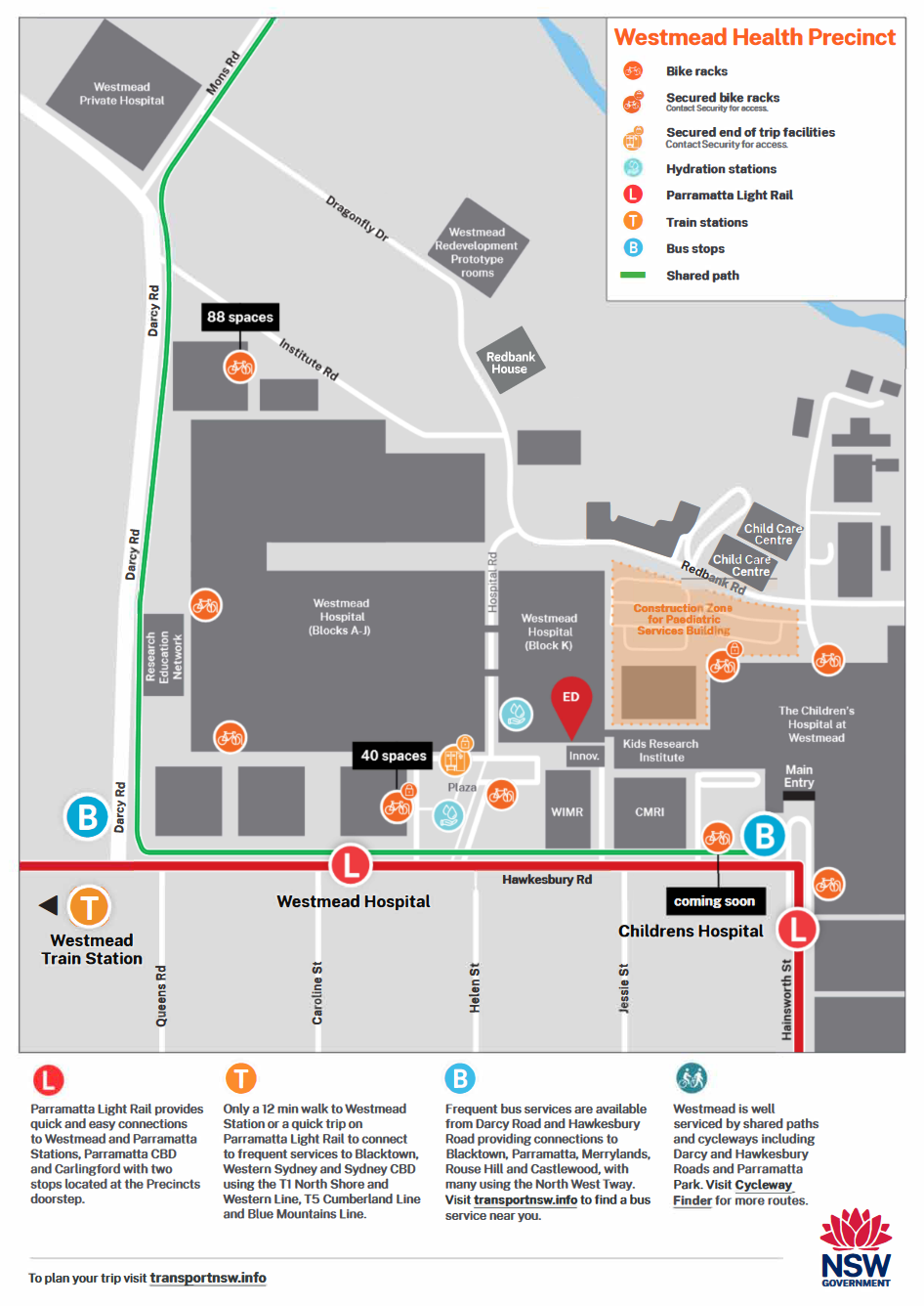
Westmead Health Precinct
Sustainable Travel Journey Guide
The Westmead Health Precinct is home to four major hospitals, five medical research entities and two university campuses that are located close to public transport.
The area is well serviced by public transport connecting the Westmead Health Precinct with Greater Sydney. In many cases it is faster and more convenient to travel to Westmead by public transport than private vehicle.
Consider these travel tips below, when visiting the Westmead Health Precinct:
Download PDF version >
Starting your new trip journey to Westmead Health Precinct?
Download this flyer for tips and information to get you started >
Don’t take our word for it, check out Bharat’s story and how he uses public transport for his journey to work.